Keo Yen Panorama
Keo Yen Panorama

Introdution

Price: Free

Phone: (0206) - 3854 211

Time to visit a place: 120 phút

Open Time: 7:00 AM - Close Time: 6:00 PM

Email: thongtindulichcb@gmail.com

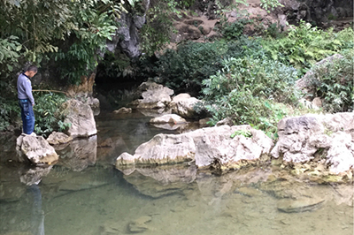
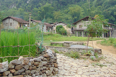
Address: xa Lung Nam, huyen Ha Quang, tinh Cao Bang Xã Lũng Nặm, Huyện Hà Quảng, Tỉnh Cao Bằng

Located in Keo Yen Commune, 15 km to the northeast of Ha Quang Town, Keo Yen valley is developed along a northwest-southeast oriented fault. The valley is quite narrow in the northwest, expanding gradually to the southeast. Its surface is also inclined toward the southeast, hence it is called "pocket valley". A stream in the valley flows only during the rainy season. However, it is strong enough to carry boulders from the bed and stream banks. At the valley margin, the mountain slope is quite steep but its ridge line is relatively flat. A cluster of flat peaks forms a planation surface, which reflects a fairly stable tectonic phase. The entire area, including the valley, mountain slope and peaks as seen at Keo Yen Commune, is developed on limestone, which was formed under warm and shallow marine conditions c.300 million years ago. But the current landscape reflects much younger geological processes such as weathering, erosion etc., which have been taking place since c.5 million years ago, resulting in typical peak cluster-depressions of the tropical karst. In addition to geoheritage value, visitors can also experience other values such as the “rock culture” of the local people, who for generations live together with rock, adapting ... View more

Map

Introdution

×

Located in Keo Yen Commune, 15 km to the northeast of Ha Quang Town, Keo Yen valley is developed along a northwest-southeast oriented fault. The valley is quite narrow in the northwest, expanding gradually to the southeast. Its surface is also inclined toward the southeast, hence it is called "pocket valley".
A stream in the valley flows only during the rainy season. However, it is strong enough to carry boulders from the bed and stream banks. At the valley margin, the mountain slope is quite steep but its ridge line is relatively flat. A cluster of flat peaks forms a planation surface, which reflects a fairly stable tectonic phase.
The entire area, including the valley, mountain slope and peaks as seen at Keo Yen Commune, is developed on limestone, which was formed under warm and shallow marine conditions c.300 million years ago. But the current landscape reflects much younger geological processes such as weathering, erosion etc., which have been taking place since c.5 million years ago, resulting in typical peak cluster-depressions of the tropical karst.

In addition to geoheritage value, visitors can also experience other values such as the “rock culture” of the local people, who for generations live together with rock, adapting and overcoming difficulties and enjoying blessings of the nature. This land also records many historic events during the 1941-1950 period of Vietnam’s revolution. The Keo Yen Commune was awarded the title “Hero of People’s Armed Forces during the French resistance war”. On June 14th 2014 it was also recognized by the Prime Minister as a “Safe Commune” (a commune being most of the time under control of the People’s Army during the war times).
 

Review and Evaluation


Alls
(From total review)

Sample Plan

Accommodations

Food

Attractions

Entertainment